Vanagon EuroVan
Previous messageNext messagePrevious in topicNext in topicPrevious by same authorNext by same authorPrevious page (April 2005, week 2)Back to main VANAGON pageJoin or leave VANAGON (or change settings)ReplyPost a new messageSearchProportional fontNon-proportional font
Date:         Fri, 8 Apr 2005 14:29:54 -0400
Reply-To:     Tim Demarest <tim.demarest@POBOX.COM>
Sender:       Vanagon Mailing List <vanagon@gerry.vanagon.com>
From:         Tim Demarest <tim.demarest@POBOX.COM>
Subject:      Re: New mapping program from Google with satellite images
Comments: To: Harold Teer <teer.vanagon@GMAIL.COM>
In-Reply-To:  <ffd6b090504071841156336b0@mail.gmail.com>
Content-type: text/plain; charset=us-ascii; format=flowed

That's pretty cool... I like the detail of the street maps, that big screen-filling map is *much* better than the tiny travesty MapQuest displays. I wonder if it will all shrink once Google adds up the bandwidth cost...

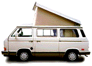
The pointer on the sat-photo is on my neighbors house instead of mine, and although I can make out my swimming pool easily, I can't make out my Westie in the driveway... either the resolution isn't quite high enough, or I was out driving it when the photo was taken.

At 09:41 PM 4/7/2005 -0400, Harold Teer wrote: >Google has released a new mapping program (beta) with satellite images of >North America. I just spent an hour working (playing) with it and you will >be impressed. > >It has the normal routing feature of map programs plus satellite images. For >example, I obtained directions to a destination and in addition to the >normal directions, I could also see an image of everyplace along the way! >Hard to explain, but you have to see this and explore the features. I used >to live in Durango, Co in the last house at the end of a street at the edge >of town. I just looked up my old address and with the satellite image, could >pick out my house and see that the whole area behind my house has been >developed. Not a surprise, but interesting to see. > >Planning a trip to EveryBus 2005, Syncro de Mayo Este 2005, BusFusion 2005, >or elsewhere? Map it out and then see what the route and destination look >like from the satellite. > >See: http://maps.google.com > >Enjoy, > >Harold >-- >Harold Teer >Harrisonburg, VA >1991 Westy


Back to: Top of message | Previous page | Main VANAGON page

Please note - During the past 17 years of operation, several gigabytes of Vanagon mail messages have been archived. Searching the entire collection will take up to five minutes to complete. Please be patient!


Return to the archives @ gerry.vanagon.com


The vanagon mailing list archives are copyright (c) 1994-2011, and may not be reproduced without the express written permission of the list administrators. Posting messages to this mailing list grants a license to the mailing list administrators to reproduce the message in a compilation, either printed or electronic. All compilations will be not-for-profit, with any excess proceeds going to the Vanagon mailing list.

Any profits from list compilations go exclusively towards the management and operation of the Vanagon mailing list and vanagon mailing list web site.