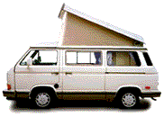

Vanagon EuroVan
Previous messageNext messagePrevious in topicNext in topicPrevious by same authorNext by same authorPrevious page (January 2008, week 3)Back to main VANAGON pageJoin or leave VANAGON (or change settings)ReplyPost a new messageSearchProportional fontNon-proportional font
Date:         Tue, 15 Jan 2008 13:32:50 -0800
Reply-To:     Loren Busch <starwagen@GMAIL.COM>
Sender:       Vanagon Mailing List <vanagon@gerry.vanagon.com>
From:         Loren Busch <starwagen@GMAIL.COM>
Subject:      Re: What are my best PC GPS options?
Comments: To: Mike Collum <collum@verizon.net>
In-Reply-To:  <478D0E26.2030407@verizon.net>
Content-Type: text/plain; charset=ISO-8859-1

I'm glad to hear that Delorme has improved the coverage in Canada. The issue Dave was trying to address is coverage in more remote areas, specifically he was asking about the interior of BC. Here in the States I didn't have any complaints about the coverage on the Delorme. But on a trip two years ago I ran the laptop most every day for three weeks. I alternated between Streets & Trips and Delorme software. And I'll stick to my opinion that the Delorme software sucks, a really bad user interface for any searching or planning. I found it very frustrating and ended up using only Streets & Trips for the last week of the trip. But, given that, I found both very poor for use in town. Both got lost and gave wrong directions when driving in traffic if the signal was lost for a few seconds. If you pulled up to a stop light neither could figure out what direction you were going when standing still and started providing directions that were all wrong. In a severe test, getting to a friends place in Kennsington, Ca. (next to Berkley) I'd still be driving in circles if I hadn't known where I was going. Summing up so far, unless you have a second person on board to act as navigator the laptop based systems fall far short. Dedicated units meant for use in vehicles seem to be a much better solution. BUT, those tend to lack the detailed coverage in the boonies, are set up for urban navigation. BTW, to any reading this, I'm all ears for any better solutions that have been found. My experience is limited at this point.

On Jan 15, 2008 11:48 AM, Mike Collum <collum@verizon.net> wrote:

> I don't know what year the DeLorme software you tried was from but the > 2008 version has greatly increased Canadian coverage. I used the 2008 > Street Atlas Plus and even the small streets (and phone numbers) in > Almonte as well as Head of St. Margaret's Bay and Halifax were shown. > Apparently, all of Canada is shown that way but those places are where I > really used it. The version I had before that only showed "most" of > Canada's main highways. > >


Back to: Top of message | Previous page | Main VANAGON page

Please note - During the past 17 years of operation, several gigabytes of Vanagon mail messages have been archived. Searching the entire collection will take up to five minutes to complete. Please be patient!


Return to the archives @ gerry.vanagon.com


The vanagon mailing list archives are copyright (c) 1994-2011, and may not be reproduced without the express written permission of the list administrators. Posting messages to this mailing list grants a license to the mailing list administrators to reproduce the message in a compilation, either printed or electronic. All compilations will be not-for-profit, with any excess proceeds going to the Vanagon mailing list.

Any profits from list compilations go exclusively towards the management and operation of the Vanagon mailing list and vanagon mailing list web site.