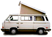

Vanagon EuroVan
Previous messageNext messagePrevious in topicNext in topicPrevious by same authorNext by same authorPrevious page (September 2008, week 4)Back to main VANAGON pageJoin or leave VANAGON (or change settings)ReplyPost a new messageSearchProportional fontNon-proportional font
Date:         Sun, 28 Sep 2008 10:39:55 -0500
Reply-To:     Chuck Mathis <cvmathis@COMCAST.NET>
Sender:       Vanagon Mailing List <vanagon@gerry.vanagon.com>
From:         Chuck Mathis <cvmathis@COMCAST.NET>
Subject:      Re: GPS recommendations, handheld & incar?
Content-Type: text/plain; charset=US-ASCII; format=flowed; delsp=yes

I'll chime in kind of late on this one. I'm a retired Coast Guard Quartermaster that started learning navigation when LORAN C was the up and coming thing - I actually learned to use a LORAN A receiver. I was also a hot s##t with a sextant. By the time I retired GPS was the thing and most of the new guys hadn't heard of LORAN or OMEGA or SATNAV. I had a brief exposure to Commander Ivan Luke a navigation instructor at the Coast Guard Academy. He was famous for walking into the nav shack on the EAGLE and turning off all the electronics because " All those red LED blinking SOBs are trying to take over the world."

I own and use a Garmin GPS III+ purchased on eBay for $50. The Garmin is nice because it is a dumb GPS - doesn't have a perky voice to tell me where to turn, etc. - just shows me where I am. It is very accurate and very dependable (as dependable as any electronic widget can be). In addition to the Garmin I always carry a good map, either one I've generated myself from Google Earth or Topo Explorer , or a commercially printed map. When planning a trip I will program in way points and build routes but more often than not I ignore them when something of interest comes along. Any map I use ends up almost illegible because I tend to make notes on them about what I've seen, bad road, great food, and stuff I might want to check out later.

Several years ago when a coworker and I were doing field work in Wyoming using a DeLorme GPS/laptop/Street Atlas setup to find our way through the wilds we followed a mapped road across the back of a large strip mine operation to the point the only way out was through the front gate or turn around and go back the way we came. On another day on the same job we found a mapped road that ended at the top of a 70 foot bluff but the map showed the road continuing several more miles.

Chuck '85 Wolfsburg Westy - 'Roland the Road Buffalo'


Back to: Top of message | Previous page | Main VANAGON page

Please note - During the past 17 years of operation, several gigabytes of Vanagon mail messages have been archived. Searching the entire collection will take up to five minutes to complete. Please be patient!


Return to the archives @ gerry.vanagon.com


The vanagon mailing list archives are copyright (c) 1994-2011, and may not be reproduced without the express written permission of the list administrators. Posting messages to this mailing list grants a license to the mailing list administrators to reproduce the message in a compilation, either printed or electronic. All compilations will be not-for-profit, with any excess proceeds going to the Vanagon mailing list.

Any profits from list compilations go exclusively towards the management and operation of the Vanagon mailing list and vanagon mailing list web site.