Date:         Thu, 24 Jun 1999 21:11:04 -0700
Reply-To:     Davidson <wdavidson@THEGRID.NET>
Sender:       Vanagon Mailing List <vanagon@gerry.vanagon.com>
From:         Davidson <wdavidson@THEGRID.NET>
Subject:      A Touch of the Southwest---- long
Content-Type: text/plain; charset="iso-8859-1"

For those interested, here's a report on my recent trip to the Four Corners
area of the Southwest:

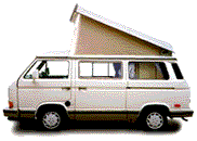
I was gone for about 5 weeks and drove about 4,000 miles. My 90 Westy Syncro
performed flawlessly both on and off road.

If you are most interested in the major tourist attractions or full service
campgrounds you needn't read on. To point of all my trips to the southwest
are to visit remote scenic areas away from the tourist crowds and to explore
for remote indian ruins... mostly the Anasazi Ruins (more commonly known as
the Cliff Dwellers, like at Mesa Verde). I do this because I love the
feeling of that country, I have a degree in Anthropology, and I am
threatening to write a book about this area of my interest.) To this end my
Syncro is perfect for heading off on remote 4WD roads. Though I only mention
small established campgrounds below, you can be sure that I know of many
remote mesa top camping spots with panoramic views of the canyons and ruins
close by... places where you don't see anyone or even hear a distant car
engine for weeks. I will leave the adventure of finding these places to you.

The best map to plan for a trip to this area (or follow my report) is the
map titled Indian Country. It is put out by the AAA Automobile Club of
Southern California and is available through AAA and at most of the parks in
the Four Corners area. For those who don't know the four corners are formed
by Arizona, Utah, New Mexico, and Colorado. I use the terms Four Corners,
Colorado Plateau, and Canyon Country pretty much synonymously.

On that map you will see many famous tourist attractions like: Monument
Valley, Canyon De Chelly, Chaco, Mesa Verde, Canyon Lands, Arches National
Park, Moab, etc. These are great cultural and scenic attractions. If you
haven't seen them, by all means do.. at least once. I saw them all many
years ago, developed an interest in contemporary and prehistoric native
American cultures, and now seek out the more remote areas away from the
tourist energy. So if I haven't mentioned the big names it's because I'm not
much interested in them any more.

My trip started May 8th at my home in Truckee, CA. and I headed down Hwy 395
to see my mother in Lake Havasu City, Arizona. Hwy 395 follows the eastern
foot hills of the Sierra Nevada range of mountains. It's a spectacular
highway, but especially so in the spring. At that time of year the high foot
hills are in bloom, the high peaks are still snow covered, and the streams
are very full from the snow melt. This exciting panorama goes on for
hundreds of miles. There are many roads that head west up the Sierra
drainages to good camping spots which are petty much empty before Memorial
Day and after Labor Day.

After visiting my mother in Lake Havasu City and my brother in Salome,
Arizona I headed north through the Verde Valley and Flagstaff. Flagstaff
(6,000 ft) sits at the base of the San Francisco peaks (sacred to both the
Hopi and Navajo indians). The Museum of Northern Arizona focuses on the
native southwest cultures and is located on Hwy 180 just outside of town.
There is a good dirt and gravel road that heads north across the street from
the museum and crosses a pass to the north side of the peaks. There is a
good off the beaten track BLM camping in that area (no camp grounds). If you
take the first main road to the right you will come out on Hwy 89 just south
of Wupatki/Sunset Crater National Monument. I visited the Wupatki indian
ruins... very nice.

Then it was onward through the Navajo Indian Reservation... Tuba City,
Kayenta, and Mexican Hat. It used to be that there were few services on the
reservation. But now there is a Supermarket and Shopping mall in Kayenta.
The best way to get along on the reservation is to treat the people like you
would like to be treated. Most of the people are great... but there are
still a few with chips on their shoulders (perhaps rightly so having read
the history of their people). And remember to treat the reservation as
private property... it's NOT okay to pull off on a dirt road here and camp.
The only camping along this stretch is at Navajo National Monument. Believe
it or not, the camping is free! It's a small quiet campground. The visitor's
center is interesting, but what I found the best were the hikes to the two
spectacular Anasazi Ruins... Keet Seel and Betatakin.

Keet Seel is the best preserved major ruin in the country! To see it you
have to make reservations months in advance (unless you're lucky enough to
get a cancellation), and it is only open from Memorial Day weekend to Labor
Day weekend. It is a 8.5 mile hike one way. You can backpack and camp over
night. Betatakin is only a 5 mile hike round trip. To see it you have to be
one of the first 25 people to line up in the morning. I hiked to Keet Seel
one day (and back) and to Betatakin the next day. One of the best
experiences was having the Navajo guides to show the ruins. They were great.

Along Hwy 163 you pass though the edge of Monument Valley... this is the
famous Marbourl(sp) Country scenery. It is on the reservation, and you can
hire Navajo guides for a jeep or horseback trip through this spectacular
country. There is a campground here, but I've never tried it.

At Mexican Hat you cross the San Juan River and leave the Navajo
Reservation. Many river raft trips leave from here or further up stream at
Bluff. You can buy showers in both places. The nearby Goosenecks of the San
Juan is a spectacular view. And the Valley of the Gods (see AAA map) is like
a mini Monument Valley where you can take the dirt loop road and camp among
these rock gods (very nice). But stay off this road during or just after a
rain... the mud will eat you alive! North of Mexican Hat, along Hwy 261 is
Cedar Mesa and Natural Bridges National Monument. On Cedar Mesa is a long
canyon called Grand Gulch (not visible from the road). It has been said to
be the best place to backpack and see Anasazi Ruins in a natural setting.
(Permits are required now, there is a ranger station along the highway.)

At the town of Blanding is another good Anasazi museum, The Edge of the Ceda
rs. Blanding has a decent grocery store (not great, but adequate). Another
place I like is the Kam Park at the Texaco gas station. No, I'd never camp
here among the RV's, but the services here are most convenient: gas,
laundry, showers, Taco Bell, trash dumpster, pay phone, grocery store across
the street, self car wash just down the street, and propane just down from
the car wash. A great pit stop if you've been out for awhile. But the best
grocery stores in the area are the two City Markets at Moab (north from
Banding on Hwy 191) and at Cortez, Co.

There is a really good Visitor Information Center in Monticello (just north
of Blanding). This is just a branch of the Visitor's Cente in Moab with is
even better. They will have all the books, maps, etc. that you may ever want
on the area. And another really good Anasazi Museum just north of Cortez
along Hwy 184 called the Anasazi Heritage Center.

Just east of Bluff is Hovenweep National Monument. Best access road is just
north of Bluff... Hwy 262 heading east is paved now. Very good, very
different Anasazi ruins... many tall towers in the open (rather than tucked
away in alcoves). And best of all it's not normally crowded. (But avoid mid
May when the nats can be fierce.) There are six different sets of ruins here
with hikes which vary from 1/4 to 4 miles round trip. The campground has a
good view of the Sleeping Ute mountain to the east and is rarely full....
VERY quiet because the rangers live next door. The road through McElmo
Canyon to Cortez is very scenic.

From west of Cedar Mesa to Hovenweep there is a lot of BLM land and dirt
roads that are open to remote camping. Just make sure you're not on
reservation land around Hovenweep.

Just south of Cortez is the Ute Mountain Tribal Park. This land is owned by
the Ute Mountain Indians. It is private land and you are not supposed to
even drive into this park without an indian guide. I hear they have a lovely
primitive campground. You can make reservations for this campground and for
tours of the ruins in the area. I didn't call early enough (they were booked
a month in advance). What is really interesting about these ruins is that
this land is contiguous with Mesa Verde National Park... home of such world
famous cliff dwellings as Cliff Palace. Mesa Verde is jam packed with
tourists that clog the roads and fill the ruins with mindless chatter. But I
hear the ruins are just as good at the Ute Mountain Tribal Park.... and A
LOT LESS PEOPLE... like in the tens instead of thousands!!!! I'm sure you
could get the phone number from information in Cortez, CO. if you are
interested.

The return leg of my trip was through Moab to Green River and then Hwy 70
and 50 across Utah and Nevada to my home in the Lake Tahoe area. There is an
interesting museum in Green River devoted to the river explorers of the
Colorado and Green Rivers. A few miles west of Green River (after ascending
the San Rafael Swell) there is an area called the Head of Sinead (in the
Sinead Country). There are maps available at the visitor center in Moab
(this area is to the north of the AAA Indian Country map), but the area is
obvious because of its sculpted sandstone bluffs that belly out and spiral
up into peaks... shapes of sand dunes and peaks with grassy grazing land
between. Take any of the dirt roads on the side of the freeway and
explore... good off the track camping in the canyons formed between the
bluffs... no water... elevation 7,000 plus so it is cooler here during hot
spells. Some really good pictographs in the area.

None of the camping that I mentioned above has showers. I recommend a solar
shower bag. I always travel with a full one in the overhead luggage rack so
that it's warm when I get to camp. Most of the campgrounds have running
water to drink, but if you're going to the remote areas TAKE LOTS OF WATER.
Remember this is called a desert for a reason.... It gets hot and it is dry.
Also be prepared for lots of strong gusty winds. I don't even bother putting
up my shade tarp any more!

And PLEASE don't drive off the existing dirt tracks (even to turn around).
We don't need any more scars on this fragile land. Thanks.

I think the best time of year is May (or perhaps mid Sept to mid Oct). By
early June it can get hot and the bugs can come out in force. July and
August can have lots of thunder storms.

Have Fun...
Bill
90 Westy Syncro

